 vesseltracker.com
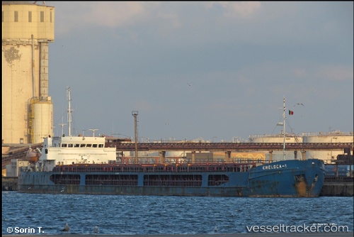
Vessel Chelsea 1 IMO: 9495612, MMSI: 511336000 General Cargo Ship
UTC, 40.73970, 28.98142, course: 43, speed: 0.7
UTC, 40.74665, 29.02885, course: 63, speed: 0.8
2026-03-04 16:08:35 UTC, 40.75576, 29.05287, course: 52, speed: 0.7
Live Vessel Chelsea 1 Analytics (details, animations, etc.)
Live AIS position: UTC. Near Maltepe), updated 2026-03-04 16:08:35 UTC.Find the position of the vessel Chelsea 1 on the map. The latter are known coordinates and path.
marine traffic ship tracker show on live map
The current position of vessel Chelsea 1 is 40.75576 lat / 29.05287 lng. Updated: 2026-03-04 16:08:35 UTCDetails:
Last coordinates of the vessel:
UTC, 40.74892, 28.96534, course: 317, speed: 0.1UTC, 40.73970, 28.98142, course: 43, speed: 0.7
UTC, 40.74665, 29.02885, course: 63, speed: 0.8
2026-03-04 16:08:35 UTC, 40.75576, 29.05287, course: 52, speed: 0.7